Frequently Asked Questions
What is a weed?
A weed is a plant growing where it is not wanted
What is an Environmental Weed?
An environmental weed is a non-native plant that has the ability to establish and spread within a natural ecosystem under its own steam.
What is a County Council?
A County Council is a “single purpose” authority established under the Local Government Act 1993 to take responsibility for one or more services provided by a “general purpose” Council. It is used most commonly with services that work well when supplied regionally, such as weed control or water supply.
Does HRCC only manage the River?
No, HRCC manages weeds across four local government areas – Blacktown, Hawkesbury, Penrith and The Hills. We control both terrestrial and aquatic weeds.
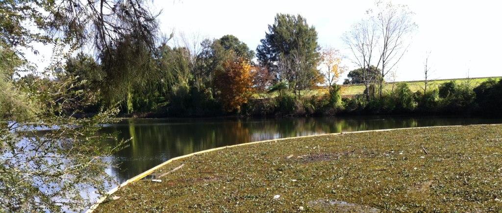
HRCC is not solely responsible for the Hawkesbury Nepean River. Our main focus is the control and management of high risk aquatic weeds which may spread causing safety, amenity or navigation issues. We deploy a series of yellow booms to catch the weed; it is then either removed by a harvester or controlled using bio-controls.
What is a bio-control?
A bio-control is the re-introduction of a natural predator to the weed. They generally don’t wipe out the weed as quickly as chemical, but slowly control its population over time. The Salvinia Weevil has been very effective at controlling the aquatic Salvinia weed in the Hawkesbury/Nepean system.
What are the yellow booms on the River?
These are booms used to trap moving weed. They are designed to not impinge navigation and should be approach directly, with momentum (motor off and lifted) and your boat will glide gently over the top.

How do weeds invade bushland?
See this article on the Blue Mountains City Council page.
How do you control weeds?
See this article on the Blue Mountains City Council page.
LINKS
Here are some useful links to sites about weeds and other plant species, organisations that are involved with weed control and also our Constituent Councils which help fund our operation. Please click on the links to read more.
Bushfire Information
For the latest Bushfire Information go to the NSW Rural Fires Services website.
Or follow their Twitter Feed via @NSWRFS or on Facebook. (these services are excellent backups if their main site is down or slow due to heavy use)
Smartphone users can download the free “Fires Near Me” app.
For the latest traffic and road conditions got to RTA Live Traffic website.
For the latest Weather Information got to the Bureau of Meteorology website.

